Drought Monitoring and Forecasting
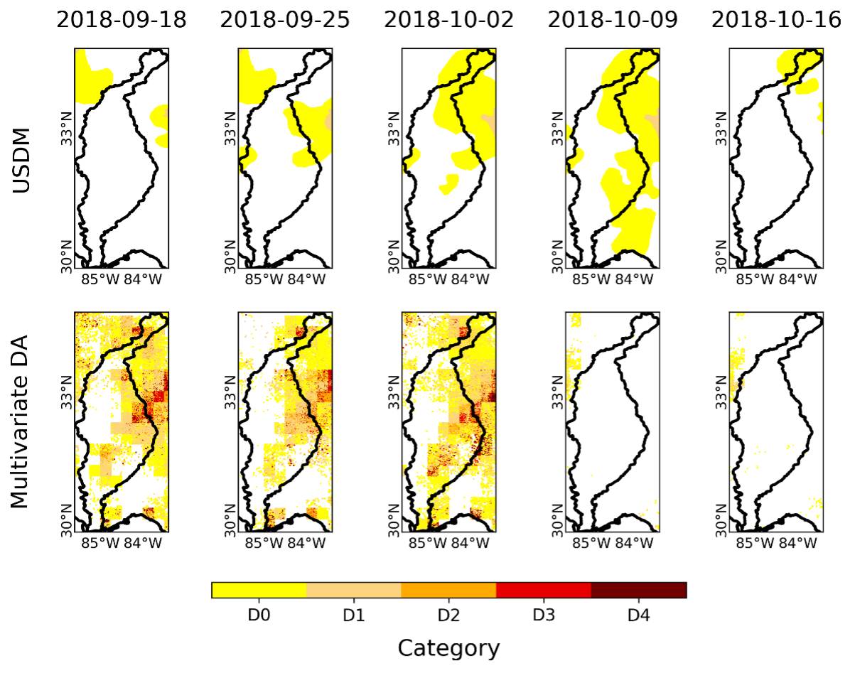
Assimilating two remotely sensed datasets, namely, Soil Moisture Operational Product System (SMOPS) and MODIS (Moderate Resolution Imaging Spectroradiometer) evapotranspiration (MODIS16 ET), at the 1-km spatial resolution, into the Variable Infiltration Capacity (VIC) hydrologic model using EPFM (Evolutionary Particle Filter with MCMC) approach for drought monitoring across Apalachicola–Chattahoochee–Flint (ACF) Basin in the southeastern United States. Link to paper
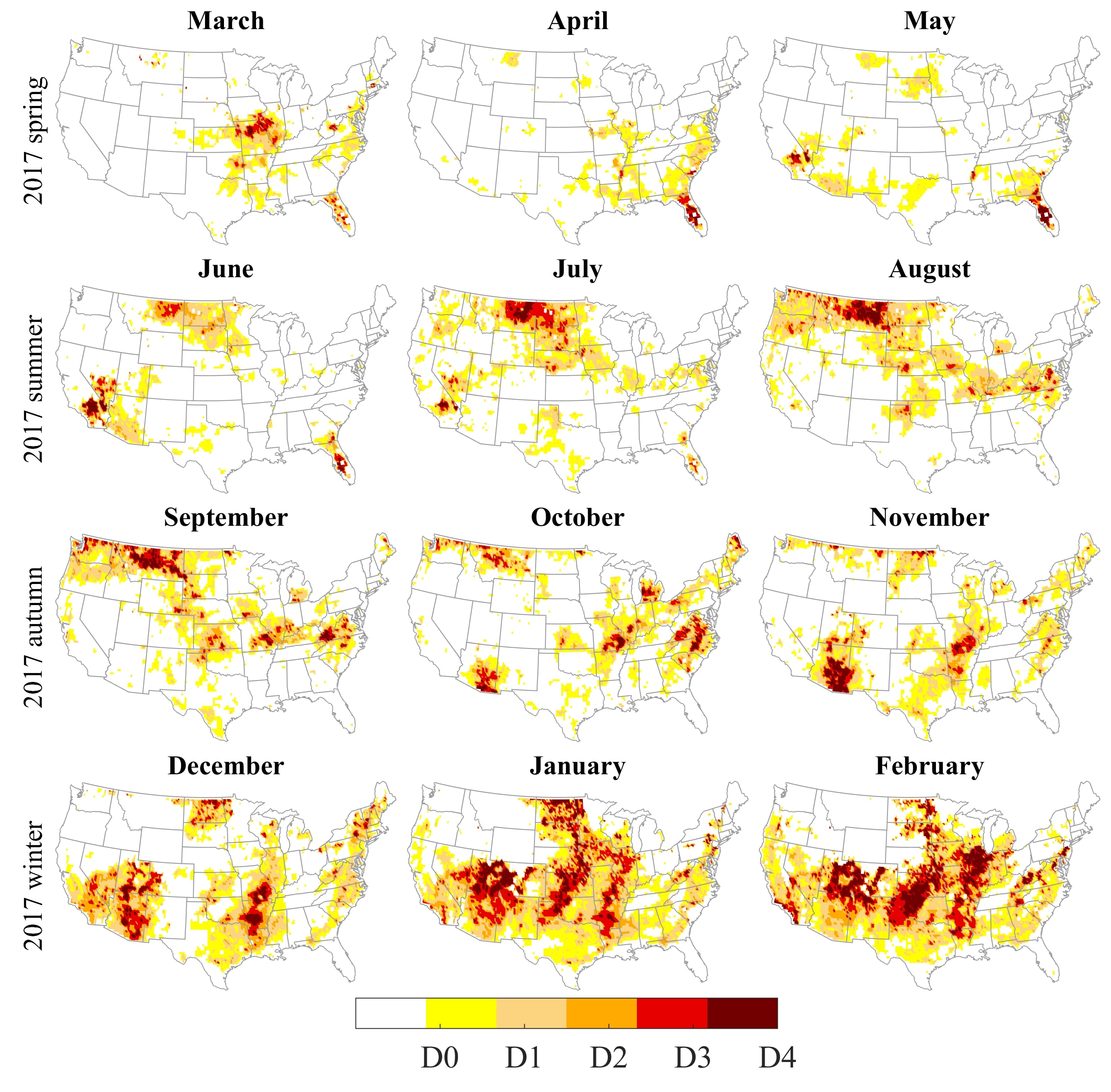
Assimilating satellite Soil Moisture Active Passive (SMAP) soil moisture data into the Variable Infiltration Capacity (VIC) hydrologic model to provide more reliable topsoil layer moisture (0~–5 cm) over the entire CONUS. We used a multivariate probability distribution based on a Copula function to integrate the posterior soil moisture, precipitation (from the North American Land Data Assimilation System (NLDAS)), and MODIS evapotranspiration information to develop a new integrated drought index, i.e., SPESMI. Link to paper
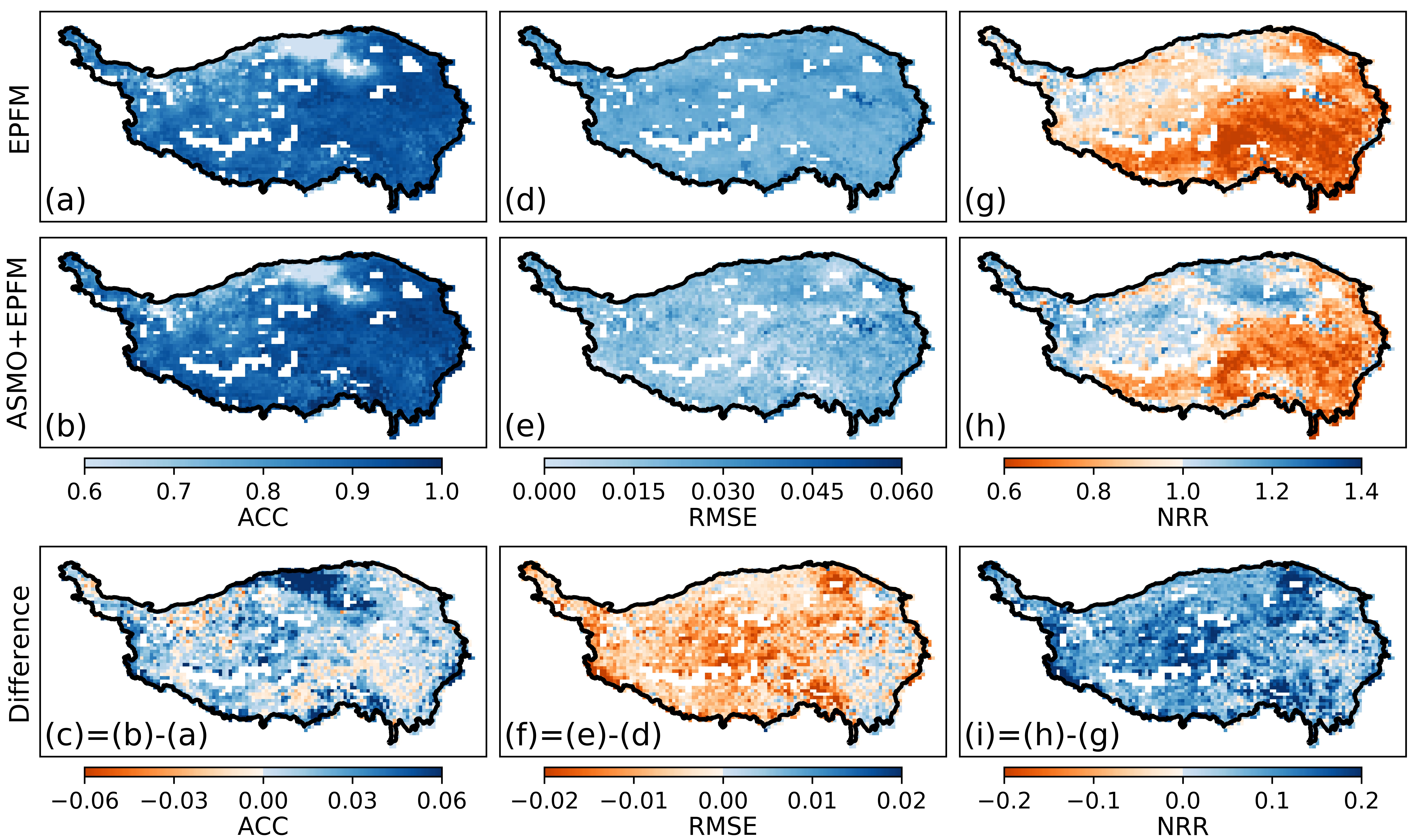
Assimilating SMAP soil moisture data into the Community Land Model (CLM) to improve model prediction skills and monitor drought across the Tibetan Plateau in China. This figure shows the spatial patterns of deterministic (ACC and RMSE) and probabilistic (NRR) performance measures by comparing the surface SM estimates from EPFM and ASMO+EPFM experiments with SMAP observation. Link to paper
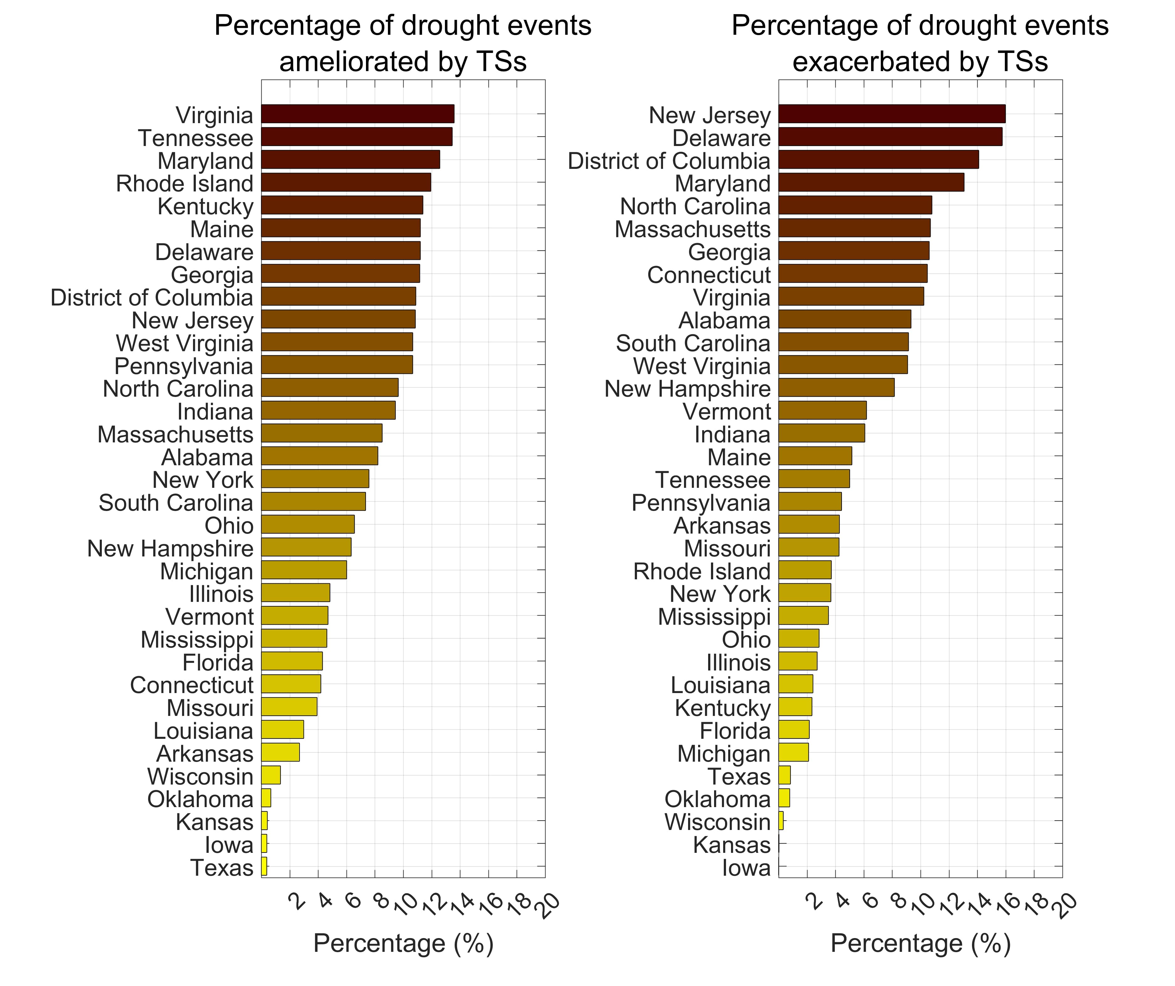
Utilizing a statistical approach to study the impact of tropical storms on agricultural drought in the Southeast United States. Link to paper
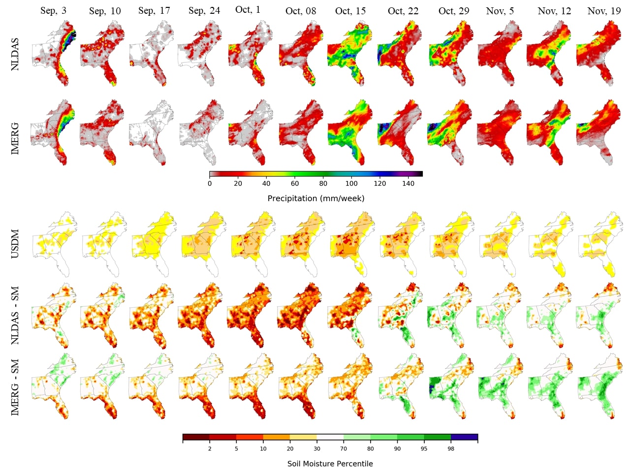
Studying the impact of different precipitation products on the land surface model data assimilation systems for drought monitoring in the United States. Link to paper
