Flood Inundation Mapping and Forecasting
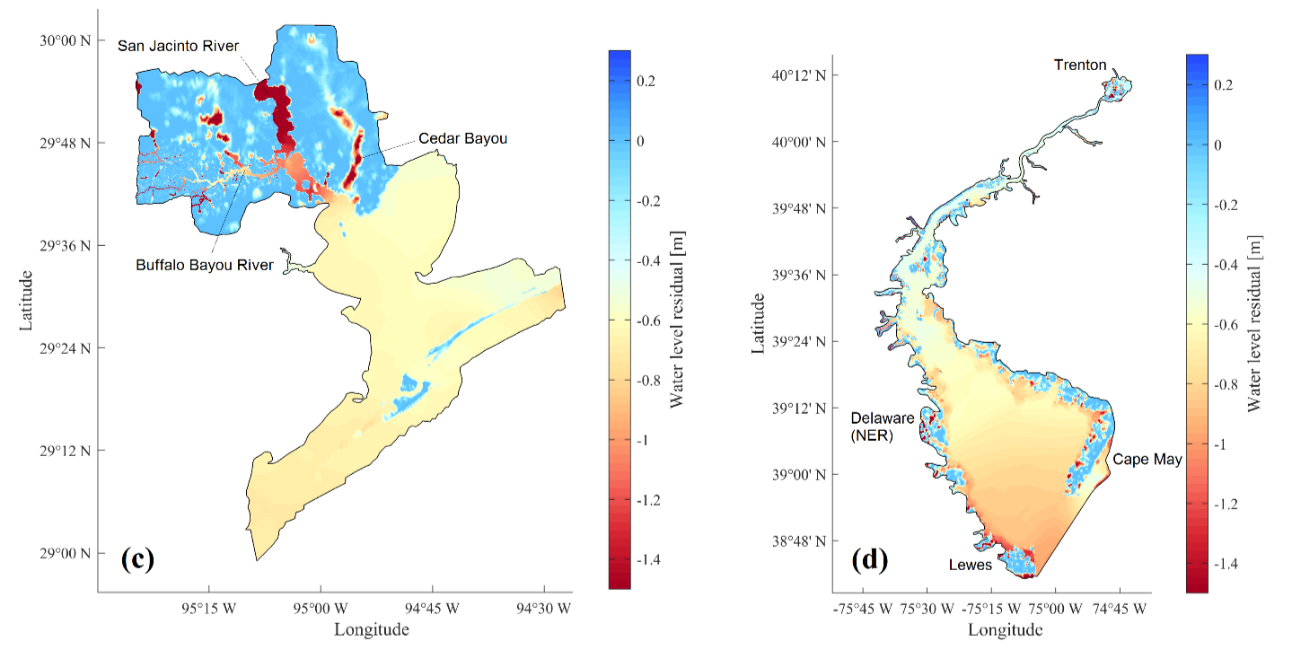
Coupling data assimilation with the Delft 3D hydrodynamic model to account for uncertainties in compound flood hazard assessment during Hurricane Harvey and Hurricane Sandy in Galveston Bay and Delaware Bay. Link to paper

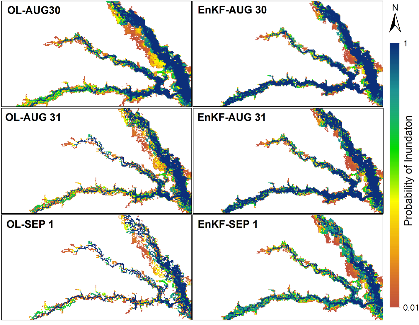
Developing a Hydrodynamic-Hydrologic (H-H) data assimilation framework for probabilistic flood inundation mapping during Hurricane Harvey in the San Jacinto watershed in Texas. In this work, We integrated LISFLOOD-FP hydrodynamic model with the EnKF data assimilation approach. Link to paper

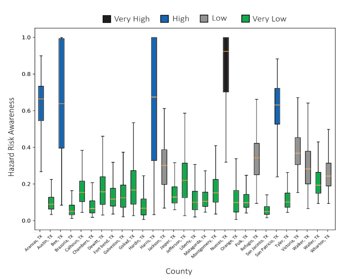
Assessing textual content from millions of tweets along with NLDAS precipitation and wind data during hurricane Harvey across several counties in southeast Texas to generate a hazard-risk awareness map during Hurricane Harvey. Link to paper

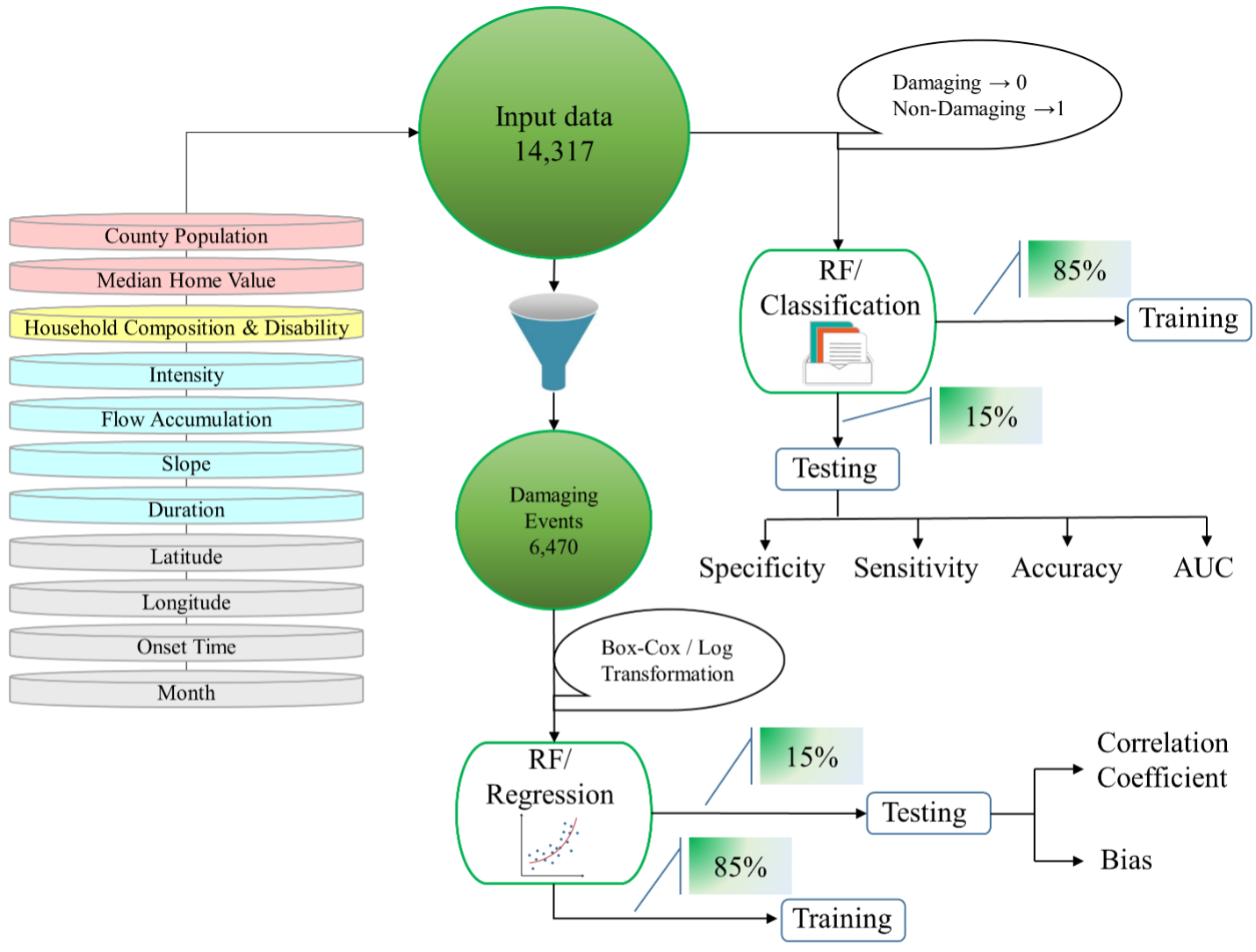
Utilizing Machine Learning techniques for predicting flash flood damage in the Southeast US. A large database of flash flood events consisting of more than 14000 events are assessed for training and testing the methodology. Link to paper
